Hiking season starts: The best tips for the next tour

Finally out again! The hiking season ring in rising temperatures and longer days. A good planning is half the battle so that nothing goes wrong in nature. We asked two trekking experts how to plan their tours and what should not be missing in the backpack.
The mountain specialist Stefan Winter from the German Alpine Association recommends the 3 × 3 model. It consists of three phases: There are three factors: In each of the three phases, tourers check all three factors – this is how a grid from nine fields (3 × 3) results in order to recognize possible dangers and counteract them in good time. « We also speak of a rolling tour planning. It never actually stops, » says Winter.
Always have possible exit points
When choosing the tour, the specialist advises to drive two tracks. So not only rely on one source – especially if you find the tour in an online portal in which users can create contributions themselves. In the past there have been repeated cases in which tours were described as supposedly easy and hikers then no longer came from the mountain alone. Because a « cozy after -work tour » is not the same for everyone. That stands and falls with experience and fitness.
« If you are healthy, do sports regularly and are not older than 60 years old, you should easily create 300 meters of altitude up an hour, » says Winter. For such people, he considers a day tour between 900 and 1,200 meters upwards to be feasible – breaks, linger at the summit and the as long descent.
Direct paths that go up very steeply are often more difficult, but tends to tend to be faster, but also more powerful. On paths with a lower slope, the total route for the same number of meters of altitude is much longer – and therefore usually also the hiking time.
The Müllerthal can also become a challenge for inexperienced hikers without appropriate equipment. Photo: Gerry Huberty
It is always advisable to have exit points. This is especially true when you hike in larger groups or with children. « If there is only one way here, this is narrowing the scope for action, » says Winter. « It is advisable to have alternatives in order to shorten the route as required or to cancel the hike prematurely. » 4.5 hours to the summit, 2.5 hours to the hut: time information can be found on many signs in hiking areas.
« They are a gross indication, » says Boris Gnielka from the journal « Outdoor ». But he would not completely rely on it, especially since other standards can be created from region to region. It is important to know the route: how many kilometers? How many vertical meters? What level of difficulty? And to have an idea of what to do. A realistic self -assessment is indispensable.
Sufficient provisions and water
On multi-day tours you should get water again and again on the go-then water filters are advisable in many areas so as not to capture any diseases. On longer tours, Gnielka relies on muesli and coffee in the morning, lunch at lunch or student food and in the evening bag food that is poured in with hot water. This is comparatively light and still provides many nutrients and energy.
Rain jacket, first aid set and a headlamp are mandatory-if contrary to expectations, the hike takes longer and it becomes dark on the descent. If you use the smartphone and use it for navigation, you should definitely pack a power bank and a charging cable to be able to charge the battery on the go.
If the cell phone does not serve as a card, you can switch it into flight mode, so it consumes less energy. Or you switch it off right away. In areas with poor network reception, an emergency can be useful. The rescue can be notified in emergencies at the push of a button – this runs via satellite reception. So you can also be located. Such devices can also be rented, says Gnielka.
View of the altitude lines
Trekkingsticks can also do well: « Especially those who have knee problems will be grateful if they can get a little weight off their legs when descending over the sticks, » says Gnielka. And uphill the legs can also be relieved a little when the arms press. The specialist advises folding models. They could be easily attached to the side of the backpack.
A well -fitting hiking shoe with a gripy sole is a must – and more important than any app.
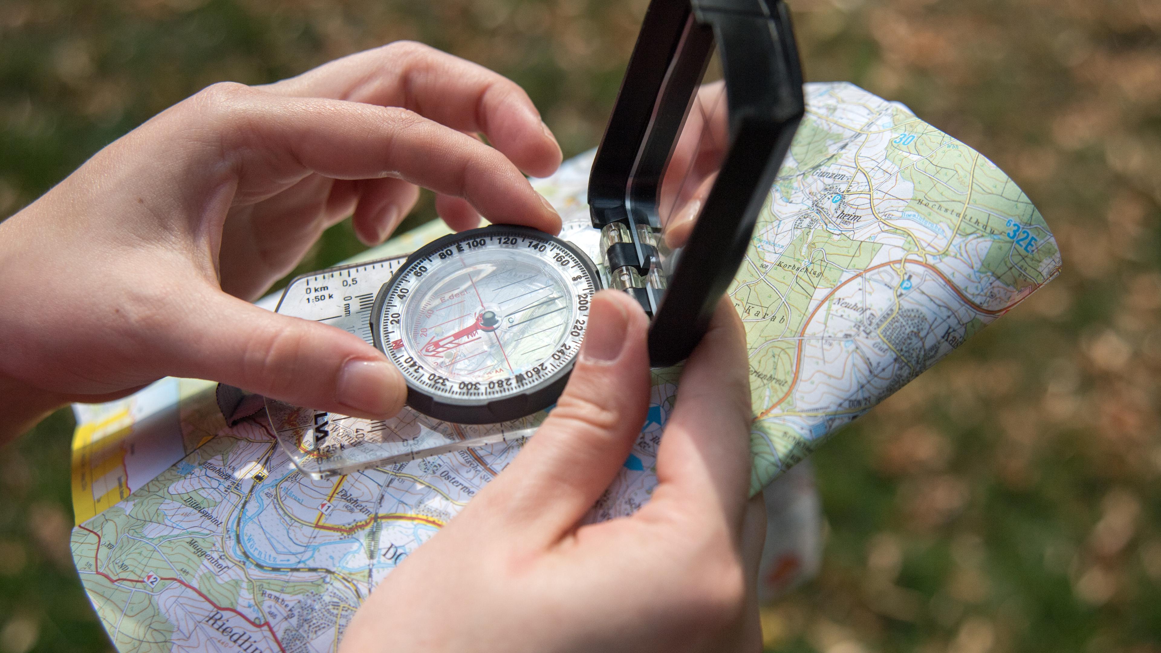
Stefan Winter is still reminiscent of a very fundamental item of equipment: « A well -fitting hiking shoe with a gripy sole is a must – that is more important than any app. » Both experts would always pack a card. On the one hand as a security if the smartphone flaps. On the other hand, a large folding card offers a better overview than a small cell phone screen. So you get a good feeling for topography and length of the tour.
Well prepared for hiking with a dog
In the selection, Boris Gnielka focuses primarily on the yardstick. 1: 50,000 is best suited for hiking, 1: 25,000 are better for mountainous terrain as in the Alps. The details are easy to see on that. According to the expert, it is important that the altitude lines are clearly visible. The closer these lie together, the steeper the area is. In flatter, more extensive areas such as Northern Scandinavia, 1: 100,000 cards often serve well. « In the Alpine region you could take this yardstick to drive, but certainly not for hiking, » said Gnielka.


