Hiking in Aichach-Friedberg: History Path for Todtenweis
The battle on the Lechfeld in 955 was an epochal event. Despite several contemporary representations, a lot remains puzzling. It only seems to be relatively secure that there was no single battle, but that in addition to a main battle, several suburbanities of various magnitude took place. It could be certain that the Hungary Her main camp on the right side of the Lechen on the so-called Gunzenle between Kissing and the Schwabhof near Augsburg-Hochzoll. A first attack by Hungary on Augsburg at East Tate is also secured. However, the main question remains, where on August 10, the main battle took place, which is referred to as a battle on the Lechfeld. A note leads to death, where you can hike on a history teaching trail on the subject.
Where did the battle take place on Lechfeld 955?
As the latest finds from Roman times suggest, this question will never be solved or only solved by chance. Because the Lech and the Wertach Covered a possible location through meter -high scree deposits due to annual floods and changes. Such a random find brought a first indication of the action in 2011.
Photo: Raab archive
The local researcher Robert Gans found on the Lechfeld near Bach, the municipality of Todtenweis, “parts of an exceptionally magnificent Hungarian horse harness. (…) The find complex is made up of 17 ornamented ornamental bins, eight flower -shaped rivets, two strokes, three large -format, leaf -shaped supporters and a forehead plate. (…) The most elaborate from the entire Hungarian area of power of the 10th century. have stood close relationship with the great prince. » (Bernd Steidl, Archaeological State Collection in Munich).
After that, it can be assumed that there was a fight nearby or that the wounded horse was left behind when the Hungarian attempts to escape. It could have heard the military leader Bulcsu. This also fits a description of the « Bavarian Chronicle » in Buch V, Chap. 4 by Aventin.
Photo: Hubert Raab
He writes: « How the Unnäking unnegrassed through Bayrn, beat Bey Augspurg and Thierhaupten, were walked to the Gälgen in Regenspurg. » A battle had taken place at Thierhaupten, meanwhile meant the whole area from the crossing of the Lech crossing near Langweid/Rehling to deadly notice to Thierhaupten.
According to King Henry I, the repeated defensive measures against the repeatedly incidental Hungarians were created of 926 smaller fortifications (ammunitions) and larger fleeing castles (firmitates). The Hungary Wall in Todtenweis documents such a protective wall system. On the one hand, their purpose was to take up the population in the Fleihburg when the hostile hordes approached, as well as to station a crew in it, make raids difficult or even prevent, on the other hand, fight the moving hordes, remove their prey and free them.
A regional saga also reports on the connection of the battle with the Ulrichsmarterl in Sand. « In 955, the Hungarians camped above Augsburg. Emperor Otto with his brave army offered them the battle, the St. Ulrich prayed for victory and pulled himself into the hot fight. The wild hordes had to succumb, the majority had been knocked down, a large part drowned in the lech, and the last rest was lost by the angry Bavarian farmers, which had lost everything below, 3 hours Augsburg.
Photo: Hubert Raab
The Regio Augsburg Tourism has made death for the subject of « 955 – Battle of the Lechfeld ». This history path is today’s hiking trail. He was staged by the Regio and the municipality of Todtenweis with its mayor Konrad Carl under the leadership of Mr. District Archives Franz Riß.
Hiking on the historical path at death: this is the route
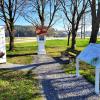
The history path begins at the Ulrichsmarterl in sand. Here you will find a detailed introduction to the history path. The second station is the equestrian statue west of the street to Thierhaupten. The horse of the Hungarian military leader Bulcsu shown here shows the dishes found nearby. Opposite the riding stele begins at the forest entrance to the third station, the Hungarian or parish hill. Here, too, there is another small parking lot.
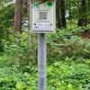
A short route along the edge of the forest, where numerous bush winds bloom in early spring, it goes up to the left a very steep and occasionally somewhat extended economic path. The well-signposted path accompany information boards and smaller signs with a QR code. The information and questions to be entered here are not only intended for adults.
Photo: Hubert Raab
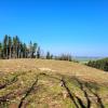
After the climb to the left, you get to the intended entrance situation with a first wall bar. Here again the hikers will soon reach the plateau. This shows the imposing, highly located and strategically extremely favorable Fleihburg in its entire size. To the right you pass the main wall, which is still six meters high, crosses another three preliminary walls, which have already been built pre -history, and comes to the right in the descent to the forest path already used when climbing. Here to the left it goes back to the starting point on the edge of the forest. For the way you should be a little gone and equipped with good hiking shoes.
The book
This hike is the book « Sunday hiking in the Wittelsbacher Land » by Gabriele and Dr. Hubert Raab taken. Price 24.80 euros, 190 pages, published by Wißner-Verlag, Sales via the bookstores in Aichach (Rupprecht), Friedberg (worth reading) and Mering (Platzbecker) and through the Aichach-Friedberg district office.

