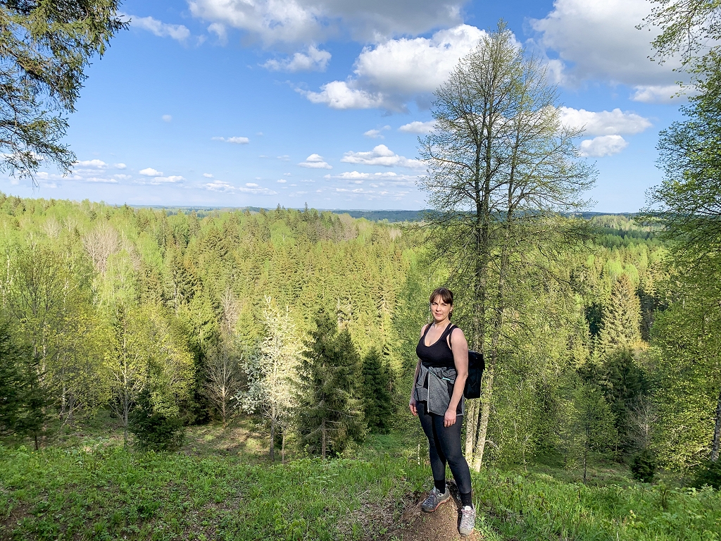
Four routes for spring hiking / day

This color combination in nature – bright but smelly, flashing – is only characterized by a short while in the spring and lasts only a couple of weeks. Something is just opening the buds for the gentle greens, something has already broken, but in other parts of the trees and the ground blooms, and everything is changing so fast! Therefore Nature day recommends four routes in each cultural and historical region of Latvia.
Kurzeme – an open -air trail along the Roja River
The Roja River Nature Trail takes you a scenic -changing route in the original forest – it combines wild, economically intact nature, the richness of animals and birds and cultural and historical stories.
The trail leads along the longest river in Talsi County – the Roja River, which stretches about 78 kilometers from Valdgale Parish to the Gulf of Riga. The river is characterized by overgrown coasts, sources and ancient shipping history – in the 17th century Baron Han used a river for export of alcohol and timber from Lubezer Manor to Riga, St. Petersburg, the Netherlands, etc.
The trail has three routes – two kilometers (yellow markings), seven kilometers (blue markings) and 15 kilometers (red markings).
All routes are circular and suitable for pedestrians, cyclists and skiers in winter. When riding a bicycle, you have to take into account sandy sections, which may be more difficult to drive.
The trail has been passing through biologically valuable forests, where there have been no forestry activities for 100 years.
Beavers, otters, elk, roe deer, as well as Gaigalas, herons, multi -species jets are home to the river. Fish in the Roja River are lamprey, trout, pike, etc. On the route, three recreational areas with infrastructure – benches, tables, campfire areas, amenities, boat berths, swings and elements of gymnastics – are available.
The starting point of the route is near Roja Maxima the store. There is also a virtual observation tower at seven QR code points, which allows you to see the surroundings in the 360 ° panorama, listening to the story of nature enthusiast Mara Olte.
In Zemgale – trail of traction nature park
The landscaped Vilce Nature Park is just 30 kilometers from Jelgava and impresses with the atypical terrain of Zemgale – the trails are not only winding, but also steep. Instead of traction and river rivers, Vilce Castle Mound has a wide view of the nearby surroundings.
The Vilce neighborhood offers a route that combines the proximity of water, natural diversity and local cultural history. This route is suitable for travelers who want to combine shasting (moving along or river) with a walk through the countryside and forest landscapes. The main ones are the Baron and the bunny trails (about two kilometers), while the shoreling route along the traction is seven and a half kilometers long.
The trip can be started in the Vilce Manor Park, which is part of the country’s cultural and historical ensemble. From here, travelers can go far from the river and continue the walk along the Baron Trail. The early stages of the river are sandy, so the water here is clear and transparent. The surrounding flora is diverse – water lilies, blackberries – and the presence of mosquitoes, dundur and boards on the banks of the river are indicative of a typical Latvian wet habitat. But in sunny forest surrounds, white whitish blooms at the moment (Anemone nemorosa) but the meadows are mild banties (Primula veris) full. Not only can you delight your eyes, but you can also bring the benefits to tea at home or at the site of the campfire if you choose a longer route with a meal.
Next, the stage to the bunny meadow, where the traction and the Rukze rivers meet, is becoming increasingly overgrown – here the shore becomes more difficult to execute. The river resembles a frog pond, and the beaver dams deny the road, so it is advisable to continue the march on land. The Baron Trail can reach a point of view with a scenic panorama over the bunny meadow, the nature reserve area. There is a picnic place in the bunny meadow, the toilets, and here you can build tents and stay overnight.
Due to the difficulty of the river’s burden and overgrowth, it is advisable to combine shasting here with land hiking. Requires proper preparation – waterproof clothing, insects and replacement clothes.
Vidzeme – a hike along the Brasla River
The Brasla River is beloved among boats, but here is one of the most scenic hiking/adventures in Latvia.
The route is suitable for more experienced nature tourists, as it is not labeled in nature and passes through difficult forest relief stages with ups and nature obstacles – fallen trees, cliffs and slippery slopes. As a result, there is no official starting point, but the breeding house of the Brasla, from where the road crosses the HPP dam and further along the high sandstone rocks of the right bank to the Gauja. Although the trail is not labeled, it is well -moved and popular with nature lovers.
On the route, one of the most important attractions is the Jānavārtsi feature – a reddish sandstone wall located on the right bank of the Brasla about 150 meters. The rock is three to 12 meters high and consists of two parts, where there are three natural caves called « three sisters ». These are bats wintering sites. All caves are partially flooded with water. There was also the fourth cave in the Jānavārts, up to seven meters long.
Next, the route leads above the slice – an impressive, around 30 -meter -high sandstone with a distinctly reddish rock tone. It is about 170 meters long and is located on the right bank of the Brasa River. It features active erosion processes and slides, but scenic this is one of the most impressive and beautiful Brasla Valley outcrops
A little more on the road smoothly, and a black rock is reached, with a rest and campfire on the river. The black rock is called the most picturesque rock of the Brasla River. The black rock has gained the name thanks to the black lichen overgrowth. You can stop here for a meal, but bring your own and food. Just above the black rock is the black rock mound, a national archaeological monument, which shows population in ancient times.
Continuing the hike, the route will take up to 110 meters long and up to a 30 -meter -high cliff with a sandstone outcrop at its foot – the Buli Rock – in the middle of which was divided into a niche large buzz. There are two more builder caves and Adamait cave in the outcrop, though it has invaded.
At the bottom of the Bulu Rock there is a Ritupīte waterfall – another visually attractive object that is popular with photographers and nature watchers.
Important! As the route is not marked, it is advisable to use GPS and prepare for the hike according to: choose the right shoes, bring warm tea, shift clothes, and take into account the weather and the degree of road difficulty. The route is around 12-15 kilometers, but the relevant terrain makes it more difficult.
In Latgale – Egukalns Forest Trail
The Eglukalns Forest Trail is like the intersection of the Upper Earth Highlands and History, it is located in Svente Nature Park that is part of the protected landscape area Top ground And impresses with pronounced mountainousness, historical places and high scenic value. The trail is about four kilometers long, and it winds around Egukalns, the highest peak in the top of the top of the land (220 meters above sea level).
The trail is suitable for both families and experienced hikers, but it should be taken into account that the terrain is highly mountainous and rich, in some places it can be difficult to walk around children or in the elderly. The trail leads through dense forests, mossy boulders, along the oak stands and World War I, which is an important historical testimony.
The route is marked with two -color flags on the trees, so orientation is comfortable. Lake Svente, which is the central axis of nature park, is distinguished by its high biological value – several protected bird species nest in reeds, such as the big rebellion, the little rebellion, the big horn, etc. Therefore, this route is particularly suitable for bird watchers and geography.
It should be noted that this is a forest trail and requires closed clothing, good grip of footwear and drinking water.


